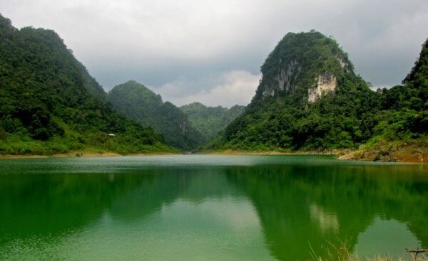
Thang Hen Lake with its beautiful landscape – Source: http://dulichcaobang.vn/
Thang Hen Lake Nature Reserve covers an area of 481.2 hectares, with 36 lakes on high mountains, of which Thang Hen Lake is the most typical. The lake is diamond-shaped, about 300m wide, over 1,000m long, with clear water all year round; surrounding the lake are overlapping ranges of rocky mountains. Geographical scope, belongs to Quoc Toan commune, Quang Hoa district.
Thang Hen Lake was recognized as a National Scenic Spot under Decision No. 53/2001/QD-BVHTTDL dated December 28, 2001 of the Ministry of Culture, Sports and Tourism. Thang Hen Lake is mentioned as one of the prominent and attractive eco-tourism destinations in Cao Bang. Coming to Thang Hen Lake means coming to the complex of lakes – caves – rivers – underground caves in this area, with many poetic, charming and mysterious landscapes attracting domestic and foreign tourists to visit.
The Thang Hen Lake Complex is recorded to date as consisting of 36 natural lakes connected to each other through a system of caves, rivers and underground caves, each lake is a few dozen to a few hundred meters apart, all located in a large valley bordering Quoc Toan Commune (Tra Linh) and Ngu Lao Commune (Hoa An). The lakes are named in the local language, such as: Thang Vat, Na Ma, Thang Loong, Thang Hoi… existing for hundreds of years, of which Thang Hen is the largest lake with a length of nearly 2,000 m, a width of 500 m and a depth of up to 40 m, surrounded by old forest canopies interspersed with cat-ear rocks.
Thang Hen in the local language means “bee tail”, because from above, looking down, visitors will see the whole lake shaped like a giant bee’s tail. Thang Hen Lake complex is located in the Non Nuoc Cao Bang UNESCO Global Geopark.
According to scientists, the Thang Hen underground lake-river-cave complex developed in the limestone of the Bac Son formation. At the intersection of the Northwest-Southeast, Northeast-Southwest, sub-longitude and sub-latitude fault systems. The lakes are located at the bottom of closed valleys, surrounded by peaks that are still connected to each other through low saddles, creating a typical karst landscape in the form of valley-peak clusters.
The summits are fairly level, remaining a level surface at about 650 m, while the valley floors range from 550 to 600 m. Waterlines show that the lake level fluctuates by about 20 m around the 600 m level. Several fossil cave floors are observed between 600 and 650 m, while active caves are still present at lower levels.
According to the 2012 survey results of a French-Vietnamese cave expert team, part of the underground cave system connecting to Thang Hen Lake developed up to 820 m in sub-longitude and sub-latitude directions and up to 54 m deep compared to the current terrain.
Source: Department of Natural Resources and Environment


