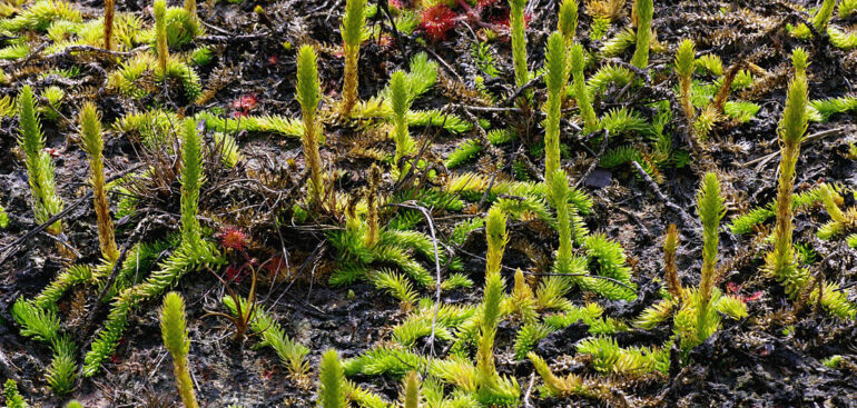
Pine (Lycopodiella) – Photo on page https://vi.wikipedia.org/
Copia Nature Reserve (KBTTN) was established in 2002, located in 4 communes (Co Ma, Long He, Chieng Bom and Nam Lau) of Thuan Chau district, Son La province, 70km east of Son La city, with a total area of 19,745ha, of which the natural forest area is 13,426ha. Copia Nature Reserve is located at 21o15’to 21o25’North latitude , 103o30’to 103o44’East longitude .
In terms of terrain, limestone mountains occupy most of the area of Copia Conservation Area, many peaks are over 1,500m high: Copia Peak 1,817m, Trong Sia 1,743m, Long Noi 1,687m. The mountain ranges run in the Northwest-Southeast direction, interspersed with valleys. The average height of the mountain ranges is over 1,000m. The Copia area has a rich stream system, flowing into the branches of the Da River and the Ma River, such as Nam Nop, Hua Luong, Hua Nhu, Nam Lu streams…
Because the Copia Reserve is at high altitude and is influenced by the northeast monsoon, the average annual temperature is relatively low (19 o C). Frost and ice occur every year. The average rainfall is 1,500-1,600mm/year, concentrated from May to August, with an average humidity of 85%.
The vegetation in Copia Reserve is rich and diverse, with 609 plant species belonging to 406 genera, 149 families, and 5 phyla. The vegetation includes the following basic types: Closed evergreen broadleaf forest, subtropical humid, distributed at altitudes above 1700m; Closed evergreen broadleaf forest, subtropical rainy season, distributed at altitudes from 800-1700m; Recovered secondary forest; Tall shrub grassland mainly consisting of trees belonging to the Bamboo subfamily (Bambusoideae) and Pine forest (Lycopodiella).
Source: Department of Natural Resources and Environment


