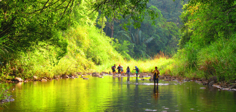
Bu Gia Map National Park – author: Kieu Dinh Thap
Bu Gia Map National Park was upgraded from Bu Gia Map Nature Reserve according to Decision No. 170/QD-TTg dated November 27, 2002 of the Prime Minister to achieve the goal of sustainable development in the locality and region. First of all, Bu Gia Map National Park was established to preserve and develop the standard model of evergreen closed forest ecosystem on low hills with an altitude of less than 1,000m and representing the transitional area from the Central Highlands to the Southern Delta. The total forest area of Bu Gia Map National Park is 25,601.18 ha, of which the natural forest area is 25,505 ha (4,134 ha of rich forest, 1,310 ha of medium forest, 169 ha of poor forest, 304.8 ha of restored forest, 17,851 ha of mixed forest, and 1,776.5 ha of bamboo and reed forest). This is an ideal place for scientific research to preserve rare genetic resources of flora and fauna. With an evergreen forest ecosystem with a coverage of over 90%, Bu Gia Map National Park contributes to protecting and regulating water resources for hydroelectric and irrigation lakes in the downstream of Be River. With its landscape and ecological values, Bu Gia Map National Park is also an attractive eco-tourism destination due to its forest ecosystem and mountain ranges transitioning from the highlands to the plains.
Bu Gia Map National Park is a transitional area from the Central Highlands to the Southern Delta, so it has its own unique characteristics in terms of mountainous terrain and rivers and streams. The terrain of the park is mainly low hills and the altitude gradually decreases from West to East and from North to South. The highest mountain peak of the park is 738m above sea level and the mountains at these altitudes appear mainly in the area bordering Dak Nong province. Due to the transition from the plateau to the plain, the terrain of the park is strongly fragmented. The mountain ranges are often interspersed with streams, creating a diversity of landscapes as well as habitats for flora and fauna throughout the park. The fragmentation of the terrain also creates poetic waterfalls in the park and is an attractive landscape for ecotourism activities. In addition, these characteristics create diversity of flora and fauna as well as clearly demonstrate the role of the forest ecosystem of Bu Gia Map National Park in biodiversity conservation.
Bu Gia Map National Park plays an important role in biodiversity conservation not only at the national level but also at the international level. Bu Gia Map National Park is adjacent to nature reserves in the Kingdom of Cambodia, and these reserves create an East-West ecological corridor that contributes to the conservation of globally endangered species such as the yellow-cheeked gibbon, Java pangolin, Asian elephant, black-shanked douc langur and many other rare species. In the country, Bu Gia Map National Park is a transitional area between the plateau and the plain in the last section of the Southern Truong Son range, with typical forest types of semi-evergreen and lowland evergreen ecosystems, distributed on lowland terrain with an average altitude of 300 – 750 m above sea level. These terrain features have created species and habitat diversity in the forest area of Bu Gia Map National Park.
Bu Gia Map National Park has two main forest types including tropical evergreen closed forest and tropical moist semi-evergreen closed forest. These two forest types create diversity of plant species and provide habitat for many animal species. Recent surveys have recorded 1,117 plant species belonging to 475 genera, 128 families, 59 orders, and 5 vascular plant phyla: Lycopodiophyta, Equisetophyta, Polypodiophyta, Pinophyta, and Magnoliophyta. All genera and species have been updated according to the latest nomenclature, and all species of cultivated origin have been removed from the plant list.
Bu Gia Map National Park is a place to preserve many rare plant species ranked according to the assessment scale of the world conservation union and the Vietnamese government. According to the assessment scale of the International Union for Conservation of Nature (IUCN-2009), the Vietnam Red Book (SDVN-2007) and Decree 32/2006/ND-CP of the Government (ND32CP), the flora in Bu Gia Map National Park has 52 plant species that need urgent conservation measures, accounting for 5.07% of the total number of species. In terms of rarity, there are 18 species at the Lower Risk (LR) level, accounting for 1.75%, 15 species at the Vulnerable (VU) level, accounting for 1.46%, 13 species at the Endangered (EN) level, accounting for 1.27%, and 6 species at the Critically Endangered (CR) level, accounting for 0.58%. In particular, the forest here also has the characteristics of a rich primary forest with the advantage of oil trees and many rare legumes such as rosewood, red oak, and rosewood. The richness of plant species and the diversity of terrain create habitats for animal species to thrive.

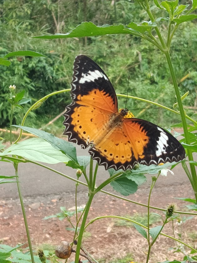
Butterflies of Bu Gia Map National Park – source: vuonquocgiabugiamap.vn
The diversity of plants creates many suitable habitats for animals, so the forest area of Bu Gia Map National Park has recorded a high diversity of animal species. According to the overall biodiversity survey in Bu Gia Map National Park in 2012, scientists recorded at least 104 species of mammals belonging to 70 genera, 29 families, and 12 orders. Also in this study, 246 species of birds were discovered and these species belong to 45 families and 15 orders. In addition, the results of field research also provided the latest list of 63 species of reptiles and amphibians belonging to 19 families, 3 orders, and 2 classes. Scientists also recorded 39 species of freshwater fish in the river habitat of Bu Gia Map National Park. In addition, the survey results reported a list of more than 273 species of insects in Bu Gia Map National Park. High biodiversity has contributed to creating a suitable living environment for local ethnic communities in terms of culture, economy, and society.
There are two local ethnic groups, the Stieng and the M’Nong, who have a long-standing tradition of association with the Bu Gia Map mountains and forests. In the past, these ethnic groups lived mainly along the primeval forests and their lives relied on hunting, gathering, and slash-and-burn cultivation. From their natural, economic, and social characteristics, these ethnic groups have created for themselves traditional cultural features closely associated with the natural mountains and forests, such as gong festivals, water playing customs, sacred forests, leaf trumpet playing, and many other typical cultural activities. Currently, with support policies from the state and local authorities, these ethnic groups have reduced their dependence on forest resource exploitation and are turning to using their existing indigenous knowledge to contribute to biodiversity conservation in the Bu Gia Map National Park. Communities participate in forest protection through payment for forest environmental services programs and develop ecotourism to conserve biodiversity in the park forest.
Indigenous ethnic communities have been actively participating in using internal resources to develop various types of ecotourism in and around the park. These communities still preserve many cultural features for visitors such as gong festivals, traditional trumpet playing, protecting sacred forests, weaving brocade, and making traditional tools. In addition, they also process foods typical of the culture of local ethnic groups such as making rice wine, cooking soup, bamboo-tube rice, and many other special traditional dishes. These activities combined with the natural conditions of Bu Gia Map National Park and historical evidence from the war to defend the country have created an intangible cultural space with its own unique features of Bu Gia Map National Park.
In addition to the values of the environment and traditional cultural space, the forest area of Bu Gia Map National Park is also a place that preserves many historical relics recreating a heroic period of the nation. The main road DT741 passing through the forest area is a vital road connecting the Central Highlands with the Eastern provinces, designed on mountainous terrain. Although designed on mountainous terrain divided by rivers and streams, the route with a length of more than 20km connecting Binh Phuoc and Dak Nong provinces does not have any river crossings while still ensuring optimization in the design and construction process of this road. Along this DT741 route, we can also admire the end point of the thousands of kilometers long petroleum pipeline connecting from the North to supply fuel to the entire southern battlefield. In addition, we also have the opportunity to visit the Hoang Cam stove, a type of stove named after the adoptive brother who created this product, which was widely used in the two wars to save the nation.
With its natural and social characteristics, Bu Gia Map National Park has been performing well its role in biodiversity conservation associated with scientific research to protect upstream protection forests, develop ecotourism, and contribute to local economic development. To fully admire the beauty of Bu Gia Map National Park, we can participate in activities to learn about local cultural customs, walk along the border patrol route or DT 741, picnic activities, sleep in huts, bathe in streams, learn about sacred forests, visit rescue areas, participate in gong festivals, enjoy traditional dishes and many other activities. These activities will give us a panoramic view of the harmonious rhythm of life between people and nature around Bu Gia Map National Park.
Source: Department of Natural Resources and Environment


